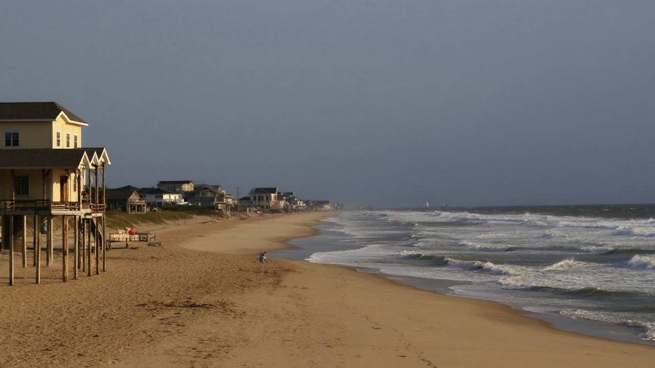
North Carolina’s Outer Banks Face Major Disruption as Hurricane Erin Approaches
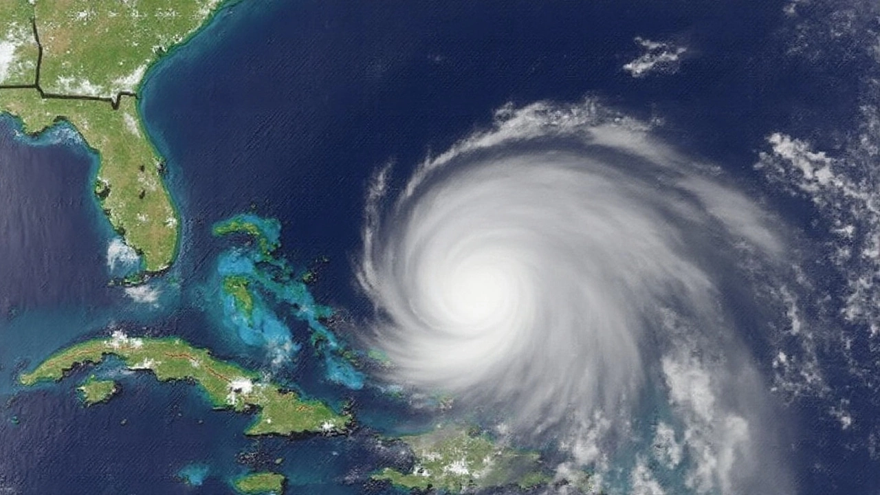
Hurricane Erin is churning up trouble along North Carolina’s Outer Banks, and it’s not messing around. With the storm just offshore, officials aren’t taking any chances: evacuation orders are in full swing and emergency teams are on high alert. The beaches that usually draw families and surfers are now under threat from huge waves, fierce winds, and flooding that could turn a vacation paradise into a disaster zone.
Dare County—the stretch covering Hatteras Island and its communities like Rodanthe, Waves, and Frisco—has thrown the whole region into a state of emergency. Here, visitors got the order to pack up and leave on Monday, while locals had to start moving out by Tuesday. Over on Ocracoke Island in Hyde County, the pattern is the same. Emergency officials declared their own crisis and told everyone, tourists and residents alike, to find safer ground.
And let’s not sugarcoat this: officials are nervous for good reason. The National Hurricane Center has tropical storm warnings posted, and storm surge watches are in place. The ocean is angry, with swells building to between 15 and 20 feet—enough to batter roads and crash into neighborhoods close to the water. Even if Hurricane Erin stays offshore, the effects are still dangerous. Roads can flood, homes are at risk, and those trademark Outer Banks dunes? They won’t be able to block everything that comes ashore.
Impacts Up and Down the East Coast
This isn’t just a North Carolina problem. Erin’s reach is long, and the storm has kicked off high surf advisories all the way from Savannah, Georgia, through Charleston, South Carolina, and up into the Northeast. If you thought you’d escape by heading north, think again—New Jersey and Long Island could see waves as tall as 12 feet by Thursday. Lifeguards are warning locals and visitors not to take chances. Life-threatening rip currents will be around for days, so swimming is off the table for now.
The most intense storm impacts are expected Tuesday and Wednesday in the Carolinas. After that, as Erin pushes north, the rough surf and dangerous currents will travel with it, keeping the entire Atlantic coast on alert for the rest of the week—and probably into the weekend.
State Emergency Management Director Will Ray summed up the mood pretty well: North Carolina’s emergency response teams have already lined up resources, ready to step in at any sign of trouble. That means supplies, rescue crews, and plans for whatever this storm throws at the coast. Still, officials are pleading with everyone: listen to local warnings and don’t wait around. Most injuries in these events happen to people who think it’s safe to stay when it isn’t.
As Hurricane Erin edges closer but doesn’t quite hit land, the real threat comes from how unpredictable storm surges and winds can get. Just because there’s no official landfall doesn’t mean roads won’t flood, power outages won’t happen, or summer communities won’t see significant damage. For now, the Outer Banks and much of the East Coast are in a holding pattern, waiting to see just how tough Erin wants to play it.