Record summer splits the country
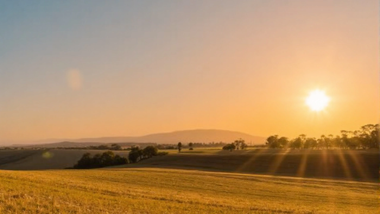
Summer 2025 has edged past 2018 to become the UK’s warmest on record. The running mean sits at 16.13°C, which is 1.54°C above the long‑term average and enough to rewrite the top line of the climate tables. You can feel that divide on the ground: the south stays hot and sticky, while the northwest is back under grey skies and outbreaks of rain.
Southern and central England have carried much of the heat in August. The South East and Central South have averaged 23.4°C for daytime highs, and many afternoons have pushed well beyond that in suntraps and city centres. Nights have been unusually warm too, trimming the usual relief after sunset and nudging up the seasonal mean.
What’s holding the warmth in place? A stubborn ridge of high pressure over and to the south of the UK has kept winds light and skies often clear across the southern half of the country. Sea surface temperatures around the UK are running warmer than normal, so onshore breezes aren’t cooling things as much as usual. Add in dry spring soils that reduced evaporative cooling, and you get a feedback loop that lifts both daytime peaks and overnight minimums. Met Office scientist Dr Emily Carlisle has pointed to that soil moisture effect as a key reason the heat has lingered.
It’s a different story to the northwest. Weather fronts moving in from the Atlantic are bringing thicker cloud, patchy rain, and a fresher feel to Northern Ireland, western Scotland and parts of northwest England. That comes after a burst of severe weather earlier in August when Storm Floris drove heavy rain and strong winds into northern Scotland. The current setup isn’t as intense, but the contrast across the UK is sharp.
Under the hood, the atmosphere is playing familiar moves. The jet stream, which steers Atlantic systems, has dipped to allow frontal systems into the northwest while looping north of the heat over the near Continent. That puts the UK in a split regime: warm, settled air in the south; cooler, moist air in the northwest. Meteorologist Craig Snell at the Met Office says that as we slide into September, the broader pattern is skewing more changeable, with dry, bright interludes in between bands of rain.
The record itself matters beyond bragging rights. A seasonal mean of 16.13°C may not sound dramatic, but a national average 1.54°C above the long‑term baseline is a large shift. It means more hot days clustered together, warmer nights, higher energy demand for cooling, and extra pressure on transport and health services during peaks. For farmers, these swings show up in uneven soil moisture, earlier harvest windows in the south, and renewed rainfall in the northwest just as some late crops reach maturity.
What to expect through early September
The near‑term picture keeps that north‑west/south‑east split. Here’s how it breaks down:
- UK heatwave south of the M4 and across much of the Midlands: Warm to hot days with long sunny spells. Humidity may creep up at times, and a few late‑day showers or isolated thunderstorms could pop where sea breezes collide inland. UV levels stay high on clearer days.
- Southwest England and south Wales: Warm inland, cooler along coasts. Increasing cloud later as Atlantic fronts edge in, with a few showers becoming more likely, especially on western hills.
- Northwest England, Northern Ireland, western Scotland: Breezier, cloudier and cooler overall. Bands of rain or drizzle moving through, with brighter gaps between fronts. Highest rainfall on exposed western slopes; eastern edges see lighter totals.
- Highlands and Islands: On‑and‑off rain and low cloud, occasionally persistent. Gusty at times in the Western Isles and along Atlantic coasts.
- East of Scotland and northeast England: Drier and brighter than the west, but cloud still thickens at times as fronts cross. Temperatures nearer seasonal norms.
Daytime highs will keep a wide spread: mid‑to‑high 20s Celsius in the southeast on the warmest days, high teens to low 20s in northern England and Northern Ireland, and mid‑teens to high teens across western Scotland under cloud and rain. Nights stay mild in the south and closer to average in the northwest.
Why the changeable drumbeat? As we step into September, high pressure weakens and slides, letting the Atlantic exert more pull. That opens the door to pulses of wind and rain, especially for Ireland, Scotland, and the northwest of England. Between systems, many areas will still enjoy clear slots and warm sunshine, particularly in the south and east.
Travel, health and the daily grind will feel these swings. Rail operators sometimes slow services in prolonged heat to protect track integrity, and spray from showers can make roads slick after dry spells. On warmer days, simple steps help: carry water, stick to shade in the early afternoon, and check on elderly neighbours who may struggle in stuffy homes. Runners and outdoor workers should aim for the morning and watch for muggy nights that leave sleep short.
For rivers and reservoirs, the picture is mixed. Southern catchments saw soils dry early, which can lead to quick runoff and localised heavy downpour impacts when showers eventually arrive. In the northwest, repeated frontal rain boosts flows but also tests hillsides and peatlands already softened by earlier storms. Water companies typically juggle demand in heat while planning for autumn recharge; the transition weeks are tight.
In cities, the urban heat island keeps nighttime temperatures elevated, especially where new builds and dark surfaces trap warmth. That’s one reason minimum temperatures have been running above average across the south. Coastal towns gain a breeze, but with sea temperatures up, the air arriving off the water is warmer than a typical late‑summer year.
Looking beyond the next few days, the signal from the Met Office stays on the unsettled side overall. Expect intervals of wet and windy weather pushing in from the west or northwest, stitched together by calmer, brighter spells—some of them still feeling summery in the south and east when high pressure noses back in. The exact timing of these swings depends on how fast the jet stream wobbles and whether the high over the near Continent can rebuild.
The headline won’t change quickly: the UK’s hottest summer on record is now in the books, stamped by weeks of persistent warmth in England and a late run of muggy days in the south. As September starts, the country moves into a balancing act—cooler air and rain knocking on the northwest door while the south squeezes a few more warm, sunny days out of a season that has already broken the records.